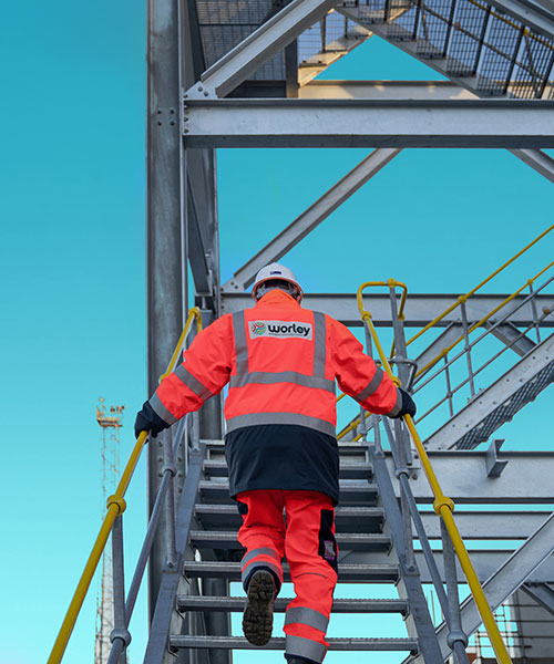
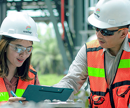
Capital project support
Transforming project delivery and implementation
Regulatory approvals and permits
Securing and accelerating final investment decisions (FID) is key to project viability. We identify potential FID red flags, reduce investment risks, and plan for navigating roadblocks.
We advise on regulations and permitting requirements, assisting with applications. Our team of environmental, engineering, and social experts provides comprehensive support. We offer strategic advice on stakeholder and regulatory engagement, ensuring customers are well-prepared for all compliance aspects.
Mapping the course to successful project delivery
A clear project plan maximizes return on investment, reduces risk, improves collaboration, and ensures efficient project delivery. We provide strategic planning and front-end development for industrial infrastructure – including ports, terminals and transport hubs – covering business cases, siting, logistics, feedstock, and modular and environmental studies.
We create and implement a holistic project roadmap considering utilities, transport, power, optimized layout, operational efficiency, spatial land use, bankability, and revenue generation.
Choosing the right technology options
We make sure customers have the best technology options for optimal project development, sustainability, cost, and schedule outcomes. Our support spans asset planning, oversight, and project execution from concept through to commissioning.
From inception, we help shape your vision for the asset of the future. Using this vision as a foundation, we help select the appropriate digital technologies and design the necessary digital infrastructure for the capital phase, streamlining asset performance in the operational phase. We implement the relevant digital infrastructure and technologies in a future-proof manner, preventing retrofitting costs later in the asset life.
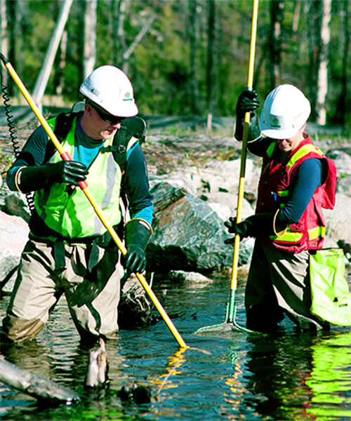
Our sustainability advisory solutions address water scarcity, water management, and climate change, offering services for industrial water use strategy, management, and flood mitigation.
We focus on optimizing the use of energy, water, and other resources through maximizing re-use, promoting the circular economy, and enhancing efficiency or conservation.
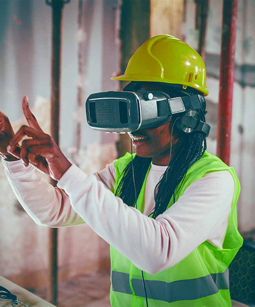
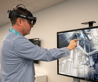
Our digital expertise transforms challenges into innovative, autonomous, and sustainable solutions for industrial assets.
Our digital twin services support the asset lifecycle, ensuring smooth transitions and seamless handovers by maintaining critical information. We enhance asset management, productivity, and safety with advanced analytics, simulations, and secure solutions, making projects future-ready and successful.
We set up effective digital twins, optimize data, and ensure full functionality for remote operations through asset hardware assessment, telecommunications, control, and Industrial Internet of Things (IIoT) systems.
A guide to sharing value and building trust with communities to achieve net zero
Growing community resistance to projects is affecting developers’ ability to deliver new infrastructure required to meet net zero. This guide outlines emerging thinking and provides practical tips for building trust with communities and other stakeholders, so critical projects can proceed.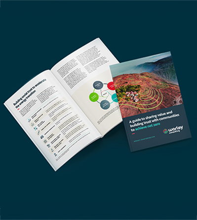
Our expertise in action


Our global team of experts

Stuart Atkinson
Water Resources, APAC
Read Stuart's story

Naim Triki
Power and New Energy, Americas

Holly Henderson
Transport, Infrastructure and Logistics, EMEA
Deepak Pandya
Energy and Chemicals, EMEA

Tanya Romanenko
Environment and Society, EMEA
Peter Israel
Power and New energy, APAC

Alex Quartey-Papafio
Energy, Chemicals and Resources, EMEA

Christine Hughes
Resource Recovery and Recycling, Americas
Read Christine's story

Benjamin Hwang
Power and New Energy, Americas
Marisa Ackhurst
Marine Structures and Coastal Engineering, EMEA

Duncan Foster
Master Planning, APAC

Gillian Coates
Water, Americas
Read Gillian's story

Julia Scott
Worley Consulting, Latin America

Antonio Cerezo
Ports and Marine, EMEA
Iyad Sbayeh
Railways, APAC

Gareth McDonald
Materials Handling, Americas

Andrea Hosey
Chemicals and Fuels, APAC

Phil Zito
Civil Engineering, Americas
Dane Pehrman
Power and New Energy, Strategy and Growth, Americas
Andrew Eastland
Ports, EMEA

John Brand
Geoscience, Americas

Alex Silver
Master Planning, EMEA

Thomas Campbell
Power and New Energy, EMEA
David Aubourg
Ports, EMEA

Adam Green
Regulatory Advisory, Americas
Read Adam's story

Carola Sepulveda
Water, Latin America
Read Carola's story

Bruce Thomas-Benke
MMM Strategy and Growth, Americas

John Jaroszeski
Land Transport, Americas

Rebecca Loseth
Transport, Infrastructure and Logistics, Americas

Chris Benstead
Power-to-X, EMEA

Ashley Coaker
Asset Development and Operations, EMEA
Read Ashley's story

Yousif Safwan
Energy and Chemicals, EMEA
Marisa Garay
Transport, Infrastructure and Logistics, EMEA
Andrew Gilham
Civil Structural Engineering, APAC

Omar Hamid
Low Carbon Fuels, Americas
Patrick McCallum
Marine Structures and Coastal Engineering, APAC

Priya Srinivasan
Regulatory Advisory, Americas

Amanda Blanksby
Marine Structures and Coastal Engineering, APAC

Bryan Carter
Business and Operations, Americas

James Assem
Water, EMEA

Frank Prokop
Mechanical Specialist, Americas

Tamer Gorgy
Environment, EMEA

Franco Di Biase
Transport, Infrastructure and Logistics, EMEA

Willa Liao
Process Design, Americas

Ignacio Moreu
Architecture and Urban Design, EMEA

Nicholas Payne
Environment and Sustainability, Americas

Steve Revill
Geoscience, EMEA

Vahid Sofali
Transport, Infrastructure and Logistics, Americas
Stuart Atkinson
Water Resources, APAC
Read Stuart's story
Naim Triki
Power and New Energy, Americas
Holly Henderson
Transport, Infrastructure and Logistics, EMEA
Deepak Pandya
Energy and Chemicals, EMEA
Tanya Romanenko
Environment and Society, EMEA
Peter Israel
Power and New energy, APAC
Alex Quartey-Papafio
Energy, Chemicals and Resources, EMEA
Christine Hughes
Resource Recovery and Recycling, Americas
Read Christine's story
Benjamin Hwang
Power and New Energy, Americas
Marisa Ackhurst
Marine Structures and Coastal Engineering, EMEA
Duncan Foster
Master Planning, APAC
Gillian Coates
Water, Americas
Read Gillian's story
Julia Scott
Worley Consulting, Latin America
Antonio Cerezo
Ports and Marine, EMEA
Iyad Sbayeh
Railways, APAC
Gareth McDonald
Materials Handling, Americas
Andrea Hosey
Chemicals and Fuels, APAC
Phil Zito
Civil Engineering, Americas
Dane Pehrman
Power and New Energy, Strategy and Growth, Americas
Andrew Eastland
Ports, EMEA
John Brand
Geoscience, Americas
Alex Silver
Master Planning, EMEA
Thomas Campbell
Power and New Energy, EMEA
David Aubourg
Ports, EMEA
Adam Green
Regulatory Advisory, Americas
Read Adam's story
Carola Sepulveda
Water, Latin America
Read Carola's story
Bruce Thomas-Benke
MMM Strategy and Growth, Americas
John Jaroszeski
Land Transport, Americas
Rebecca Loseth
Transport, Infrastructure and Logistics, Americas
Chris Benstead
Power-to-X, EMEA
Ashley Coaker
Asset Development and Operations, EMEA
Read Ashley's story
Yousif Safwan
Energy and Chemicals, EMEA
Marisa Garay
Transport, Infrastructure and Logistics, EMEA
Andrew Gilham
Civil Structural Engineering, APAC
Omar Hamid
Low Carbon Fuels, Americas
Patrick McCallum
Marine Structures and Coastal Engineering, APAC
Priya Srinivasan
Regulatory Advisory, Americas
Amanda Blanksby
Marine Structures and Coastal Engineering, APAC
Bryan Carter
Business and Operations, Americas
James Assem
Water, EMEA
Frank Prokop
Mechanical Specialist, Americas
Tamer Gorgy
Environment, EMEA
Franco Di Biase
Transport, Infrastructure and Logistics, EMEA
Willa Liao
Process Design, Americas
Ignacio Moreu
Architecture and Urban Design, EMEA
Nicholas Payne
Environment and Sustainability, Americas
Steve Revill
Geoscience, EMEA
Vahid Sofali
Transport, Infrastructure and Logistics, Americas
Speak to an expert today